about 256 BCE
Dujiangyan Irrigation System
Li Bing, governor of Shu under Qin · Min River, Dujiangyan, Sichuan, China
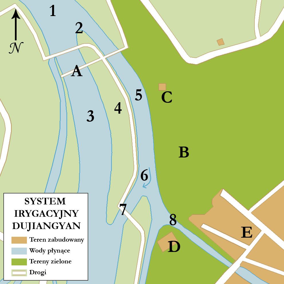
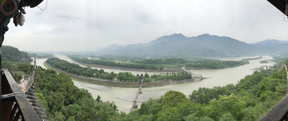
Works on the Min River that divert water for irrigation, pass sediment and control floods, in UNESCO's words without dams, using natural topography and hydrology. UNESCO records the system as still in use, irrigating 668,700 hectares of farmland.
How it came about and changed
- c. 256 BCE
Li Bing, governor of Shu for the state of Qin, was tasked with diverting the Min River to the Chengdu Plain, which suffered summer floods and winter droughts. The system was begun around 256 BCE as a dam-free diversion at the point where the Min leaves the mountains, about 50 km from Chengdu and 273 m higher.123
- Headworks design
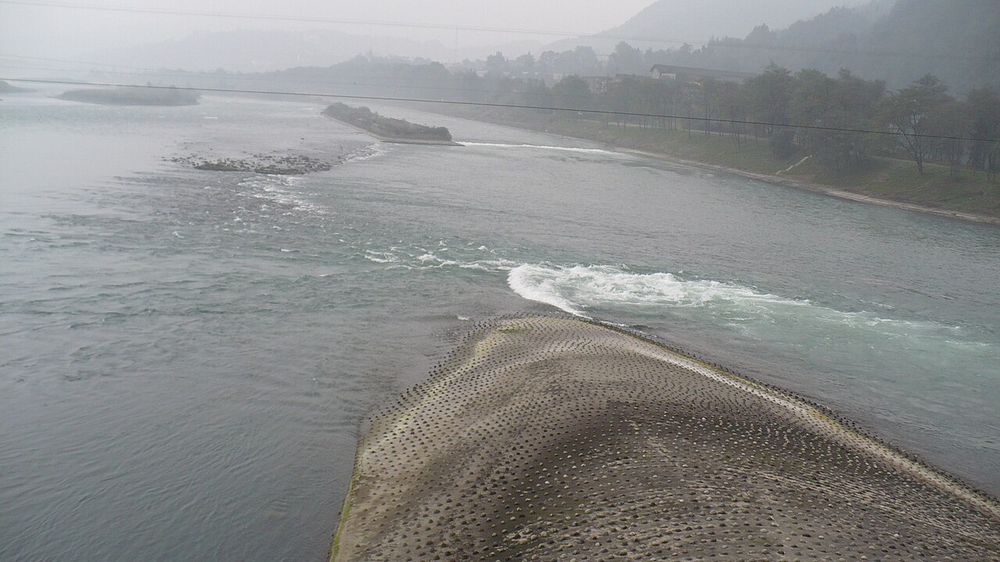
Three components work together: the Fish Mouth (Yuzui), a levee splitting the river into an inner channel for irrigation and an outer channel for flood and sediment discharge; the Feishayan, a low spillway returning excess water and sediment to the outer river; and the Baopingkou (bottleneck channel), cut through Mount Yulei, which acts as a self-regulating intake to the plain.312
- Historic operation
Operation has depended on annual dredging of a specific river section down to iron bar markers buried in the bed, summed up in the maxim 'deeply clearing channel, building low dike'; ADB notes the system has been improved throughout history.31
- 1941–1974
The first physical hydraulic model study of the system was made in 1941. In the 1970s water diversion facilities and reservoirs were built, including a check gate across the outer river in 1974, which changed the share of flow entering the inner river.31
- 2000–2006
Inscribed on the UNESCO World Heritage List in 2000 (as part of Mount Qingcheng and the Dujiangyan Irrigation System). A dam about 4 km upstream of the Fish Mouth was completed in 2006 and now evens out dry-season supply and reduces flood peaks.13
- 2018–present
ICID added Dujiangyan to its World Heritage Irrigation Structures list in August 2018. ADB reports that the system serves 23 million people, irrigating 10 million mu (667,000 ha) and supplying domestic and industrial water and flood management.41


Approvals and legal steps
- 2000 UNESCO World Heritage inscription, as part of the property 'Mount Qingcheng and the Dujiangyan Irrigation System'.13
- 2018 Listed by the International Commission on Irrigation and Drainage (ICID) as a World Heritage Irrigation Structure, announced at ICID's 69th International Executive Council meeting in Saskatoon, Canada.4
Funding
No source opened states how the original works or later maintenance were financed beyond Li Bing acting as Qin governor of Shu. Costs of the 1970s works, the 2006 upstream dam and current management are not documented here.
People
- Li Bing Governor of Shu under the state of Qin; credited with designing the system (c. 256 BCE)
- State of Qin Governing state under which the system was built
- International Commission on Irrigation and Drainage (ICID) Listed the system as a World Heritage Irrigation Structure (2018)
- UNESCO World Heritage Committee Inscribed the property (2000)
Sources for this page
- Asian Development Bank, Development Asia, Applying Ancient Wisdom to Disaster Risk Mitigation (20 August 2020)
- Science and Technology Daily, Dujiangyan: A Marvel of Ancient Hydraulic Engineering (31 March 2022)
- MDPI Sustainability; White Rose Research Online repository, Zheng, X., Kazemi, E., Gabreil, E., Liu, X., Chen, R. (2020) Sustainability of the Dujiangyan Irrigation System for over 2000 Years – A Numerical Investigation of the Water and Sediment Dynamic Diversions. Sustainability 12(6), 2431, doi:10.3390/su12062431 (open-access copy)
- China Daily, Irrigation sites get world heritage status (14 August 2018)
- Wikidata, Dujiangyan (Q824157)
Researched on 2026-11-19 from the sources listed; a fact that could not be confirmed in a source was left out. Pictures are public domain or under an open licence, credited as their file page asks.
The question it brings · interpretation
Before proposing a structure to hold water back, what could the existing landform and the river's own behaviour be made to do?
Each question is Field Method’s interpretation, not a claim made by the source.
The date
Nominal year. UNESCO says the system was originally constructed around 256 BC and later modified and enlarged in the Tang, Song, Yuan and Ming dynasties. Inscribed on the World Heritage List in 2000 with Mount Qingcheng.