1912
Plan for Canberra (Federal Capital Design Competition, entry no. 29)
Walter Burley Griffin and Marion Mahony Griffin · Canberra, Australian Capital Territory, Australia
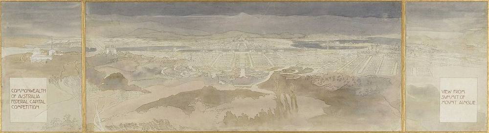
Won the international competition for Australia's federal capital from 137 entries; its axes tie the city to surrounding hills and a central water basin, and Marion Mahony Griffin made the drawings that presented it.
How it came about and changed
- 1900–1911
Section 125 of the Constitution required a seat of government in New South Wales at least 100 miles from Sydney. After site enquiries, the Seat of Government Act 1904 chose Dalgety; the Seat of Government Act 1908 replaced it with the Yass–Canberra district, the site was ratified by the Seat of Government Acceptance Act 1909, District Surveyor Charles Scrivener surveyed it, and the Commonwealth took control of the Federal Capital Territory on 1 January 1911.243
- 1911–1912
On 30 April 1911 the Minister for Home Affairs, King O'Malley, approved an international design competition, reserving the final decision to himself; competitors received materials including a cyclorama and Scrivener's contour map. The closing date of 31 January 1912 was extended to mid-February, by which 137 entries had been received; a Federal Capital Designs Board judged them and entry no. 29 by Walter Burley Griffin of Chicago was declared the winner on 23 May 1912.213
- 1911–1912 (design)
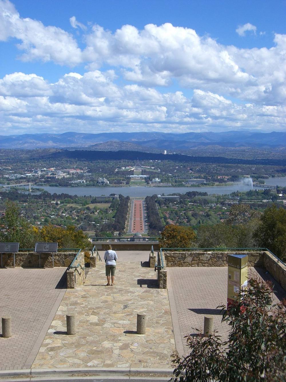
The design organised the city on axes between Black Mountain, Mount Ainslie, Camp Hill, Kurrajong (now Capital) Hill and a central basin, with a lake formed on the Molonglo flood plain, a government group south of the lake and civic functions north of it. Marion Mahony Griffin rendered the drawings on linen in watercolour, gouache and ink; the extent of her contribution to the design itself is not known.241
- 1912–1913
The three prize-winning entries were referred to a departmental board, which produced a composite plan approved in January 1913; the city was named Canberra at a ceremony on 12 March 1913. After a change of government in mid-1913 the board's plan was abandoned and Griffin was appointed Federal Capital Director of Design and Construction.32
- 1913–1920
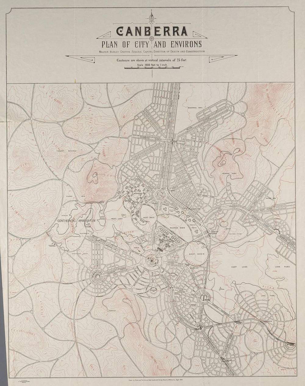
Little was built while funds went to the war effort and Griffin was in dispute with officials; a 1916 Royal Commission found his authority had been undermined. Griffin refined the plan up to his September 1918 'Plan of City and Environs'. His appointment ended in 1919 (Parliamentary inquiry) or 1920 (Griffin Society), and he declined a place on the Federal Capital Advisory Committee formed in 1921.356
- 1924–1930
The Seat of Government (Administration) Act 1924 set up the Federal Capital Commission, which took over planning, construction and administration in January 1925; the Griffin plan, with a few amendments, was gazetted on 19 November 1925. Parliament moved to Canberra in 1927; the Commission was disbanded in 1930 during the Depression.35
- 1938–1957
The advisory National Capital Planning and Development Committee operated without executive power; the period from the 1930s to the 1950s is generally described as one of stagnation.3
- 1957–1965
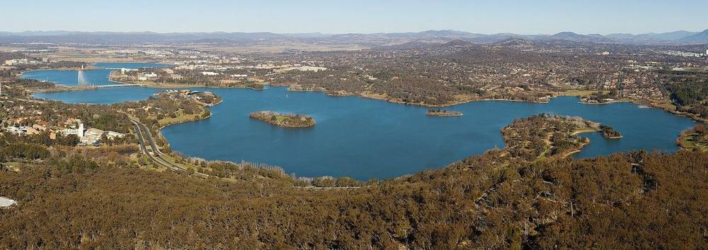
Following a 1955 Senate Select Committee report, the National Capital Development Commission was established in 1957 and took control on 1 March 1958; it recommended building the central lake, which the Government approved. Major construction of the lake was completed by the end of 1963 and it was named Lake Burley Griffin; the Kings Avenue and Commonwealth Avenue bridges, Anzac Parade and the lake were complete by 1965.43
- 1988–present
With ACT self-government, the Australian Capital Territory (Planning and Land Management) Act 1988 created the National Capital Planning Authority (renamed National Capital Authority in 1996) and the National Capital Plan; the NCA's Griffin Legacy study (2002–2004) re-appraised the Griffin plan as a basis for central Canberra. The Griffins' competition drawings, held by the National Archives of Australia, were inscribed on the UNESCO Australian Memory of the World Register in 2003.31



Approvals and legal steps
- 1900 Commonwealth of Australia Constitution Act 1900, section 125: the seat of government to be determined by Parliament, in New South Wales, not less than 100 miles from Sydney, on territory of at least 100 square miles.42
- 1904; 1908; 1909 Seat of Government Act 1904 (Dalgety); Seat of Government Act 1908 (Yass–Canberra district, repealing the 1904 Act); Seat of Government Acceptance Act 1909 ratifying the site.23
- 1911 Seat of Government (Administration) Act in force 1 January 1911: Commonwealth control of the Territory; Crown land transferred without payment, private land to be purchased, and land to be held by the Crown and leased.4
- 1911–1912 Ministerial approval of the international design competition by King O'Malley on 30 April 1911; his minute confirming the results (1912).2
- 1913 Approval of the departmental board's composite plan (January 1913), later abandoned; appointment of Griffin as Federal Capital Director of Design and Construction (1913).3
- 1924–1925 Seat of Government (Administration) Act 1924; gazettal of the 'Plan of Layout of the City of Canberra and its Environs' (the Griffin plan with a few amendments) on 19 November 1925.35
- 1957; 1988 Establishment of the National Capital Development Commission (1957); Australian Capital Territory (Planning and Land Management) Act 1988 creating the National Capital Planning Authority and the National Capital Plan.3
- 2003 Inscription of 'The Walter Burley and Marion Mahony Griffin Design Drawings of the City of Canberra' on the UNESCO Australian Memory of the World Register (inscription no. 6).1
Funding
- 1911–present The competition, the plan and Canberra's construction were Commonwealth Government undertakings; Crown land in the Territory passed to the Commonwealth without cost, while privately owned land had to be purchased, and land has been held by the Crown and leased.4
- 1914–1918; 1930 Little progress was made during the First World War because funds went to the war effort, and the Government cut expenditure on the capital in the Depression, disbanding the Federal Capital Commission in 1930.3
People
- Walter Burley Griffin Architect and landscape architect of Chicago; author of competition entry no. 29; Federal Capital Director of Design and Construction from 1913
- Marion Mahony Griffin Architect; collaborator on the entry and maker of the competition drawings
- King O'Malley Minister for Home Affairs; approved the competition (1911) and made the final decision
- Federal Capital Designs Board Judged the 137 entries (appointed February 1912)
- Charles Scrivener NSW/Commonwealth District Surveyor; surveyed the site and prepared the contour map given to competitors
- Lord and Lady Denman; Andrew Fisher Governor-General, his wife (who announced the name Canberra) and the Prime Minister at the 12 March 1913 foundation ceremony
- Federal Capital Advisory Committee (1921); Federal Capital Commission (1925–1930) Bodies that succeeded Griffin in developing the city
- National Capital Development Commission (1957–1989) Built Lake Burley Griffin and the central national area
- National Capital Authority (National Capital Planning Authority from 1989) Current Commonwealth planning authority for the national capital; Griffin Legacy study (2004)
- National Archives of Australia Custodian of the competition drawings (series A710)
Sources for this page
- UNESCO Australian Memory of the World Program, The Walter Burley and Marion Mahony Griffin Design Drawings of the City of Canberra
- National Archives of Australia, via Google Arts & Culture, Design 29: Creating a Capital
- Parliament of Australia (parliamentary committee report, aph.gov.au), The Way Forward: Inquiry into the role of the National Capital Authority, Chapter 2 'Canberra—a planned capital city'
- Australian Bureau of Statistics, Year Book Australia, 1988: A Pictorial History of the Australian Capital Territory (feature article)
- Walter Burley Griffin Society, Canberra: Soul of the Australian nation? 100 years of the Griffin Plan (Brett Odgers, September 2024)
- Wikimedia Commons, Canberra 1918 plan (file page, with National Library of Australia source)
- Wikidata, Canberra (Wikidata item Q3114)
Researched on 2026-11-19 from the sources listed; a fact that could not be confirmed in a source was left out. Pictures are public domain or under an open licence, credited as their file page asks.
The question it brings · interpretation
Which landforms around your site could carry the main lines of the plan, so that the layout still reads from the ground and not only on paper?
Each question is Field Method’s interpretation, not a claim made by the source.
The date
Date the entry won: entry no. 29 was declared the winner of the Federal Capital Design Competition on 23 May 1912. The competition was approved on 30 April 1911 and closed in mid-February 1912. The plan was revised in later years; 1912 is the competition design.