1612
Beemster Polder (Droogmakerij de Beemster)
Amsterdam merchants and Hague officials as investors; mill builder and engineer Jan Adriaenszoon Leeghwater; surveyor Lucas Jansz. Sinck · Beemster, North Holland, Netherlands
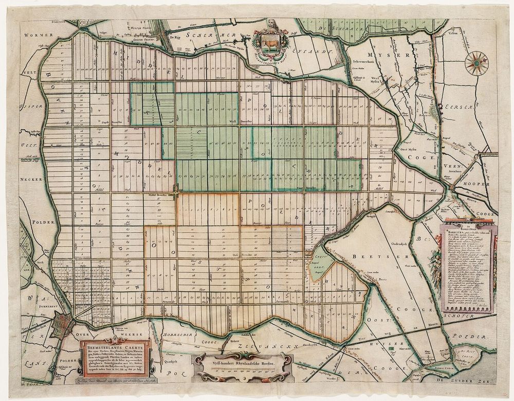
A lake drained by 43 windmills working in rows of three behind a ring dyke and canal. A January 1610 storm flooded it again; a surveyor's grid of squares was set in 1611, before the land fell dry in 1612.
How it came about and changed
- 1607
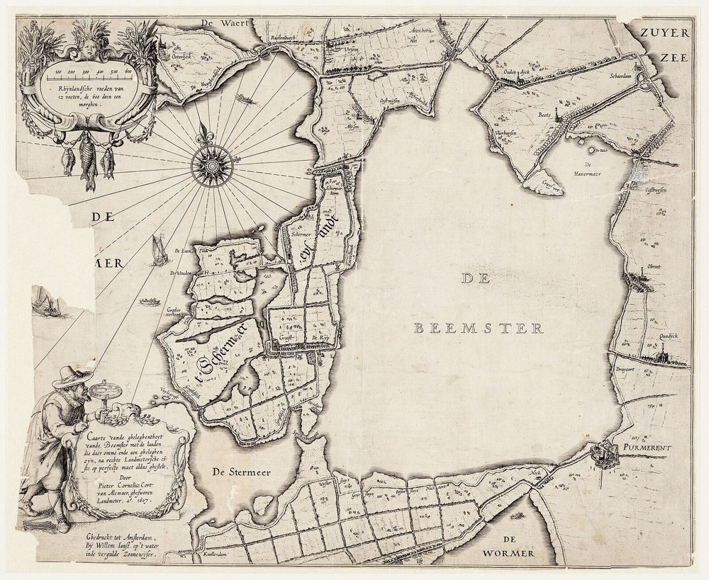
Wealthy Amsterdam merchants and senior officials in The Hague obtained a patent from the States of Holland in May 1607 to reclaim Lake Beemster, the largest lake in the Noorderkwartier. The patent went to sixteen people who founded the Beemstercompagnie to raise capital; 123 investors took part in total. The surveyor Pieter Cornelisz. Cort of Alkmaar mapped the lake and its surroundings beforehand.143
- 1608–1612
After Cort's death in 1608, Amsterdam surveyor Lucas Jansz. Sinck laid out the first dike section; construction of the ring dike and ring canal began in 1608 and windmills were built to pump the lake dry, with engineer Jan Adriaenszoon Leeghwater co-responsible for building and placing the mills. A storm in January 1610 broke through and flooded the works, which had to be largely redone with new capital. The polder was dry on 19 May 1612 and the plots were allotted in August 1612.143
- 1611–1620s
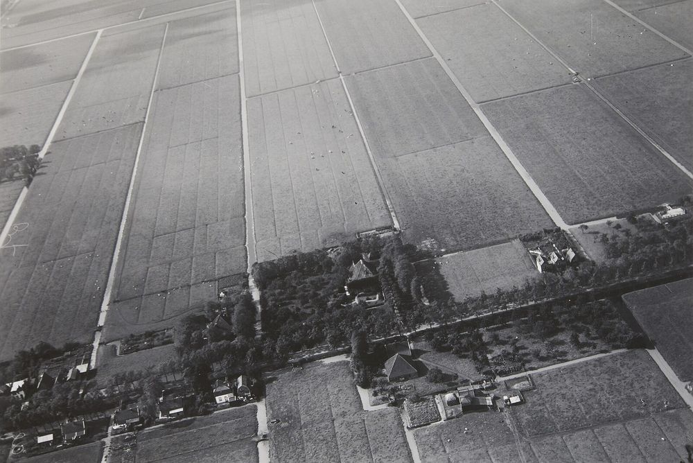
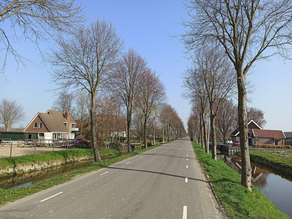
In 1611 the investors decided on the layout: a grid of roads and canals forming large squares (about 1,800 m by 1,800 m) subdivided into blocks and long lots of about 180 m by 900 m, with space reserved for villages at road crossings and a church at Middenbeemster. A by-law of 1616 set conditions on plants and trees, and the roads were planted with trees from about 1620. The ICOMOS evaluation and the water authority relate the plan to classical and Renaissance principles transmitted through Vitruvius, Palladio and Scamozzi.14
- 17th–18th centuries
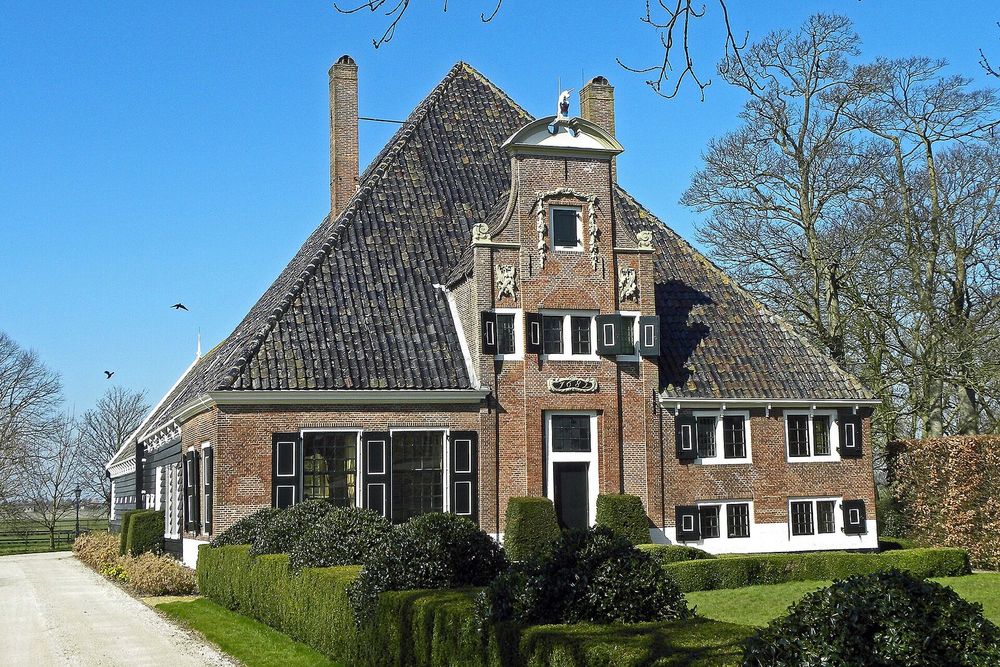
Country houses with formal gardens (lusthoven) were built as summer residences for Amsterdam owners, but most were demolished in the 18th century; square 'bell-jar' farmhouses (stolpboerderijen) fitted the grid. Land use shifted from cereals to pasture for cattle because of the high water table.1
- Late 19th–20th centuries
Wind drainage was replaced by steam pumping stations in the late 19th century, which allowed deeper drainage and the growth of horticulture; the pumps were later converted to diesel and electric power. Five forts of the Stelling van Amsterdam (Defence Line of Amsterdam) were built in the southern part of the polder. Poplars were planted on the dike after the Second World War.13
- 1999–present
The Beemster Polder was inscribed on the World Heritage List in December 1999. The Hollands Noorderkwartier water authority, with the municipality of Purmerend, is the official site holder; the polder is now divided into more than fifty sections with their own water levels, and IJsselmeer water is let in during drought.243




Approvals and legal steps
- 1607 Patent (concession) granted by the States of Holland (Provincial Council of Holland and West Friesland) permitting the reclamation of Lake Beemster.134
- 1616 Polder by-law including conditions on plants and trees, which governed the planting of the roads.1
- 1988–1996 At the time of nomination: 60 monuments in the polder protected under the national Monuments Act 1988, the polder part of the National Central Landscape of Noord-Holland under the 1991 Waterland Regional Plan, a Noord-Holland provincial Monument Decree (1996) and a Beemster municipal Monument Decree (1991, updated 1994).1
- 1999 Inscribed on the World Heritage List by the World Heritage Committee at its 23rd session (Marrakesh, 1999) under criteria (i), (ii) and (iv).2
Funding
- 1607–1612 Private investment: the Beemstercompagnie, founded by the sixteen patent holders, raised the capital from 123 investors in all, who received a return of 17% on completion in 1612.1
- 1610–1612 After the 1610 flood new capital was raised; total costs rose to 1.6 million guilders, which the water authority compares to approximately 30 million euros in 2023.4
People
- Amsterdam merchants and regents and Hague officials (Beemstercompagnie) Initiators and investors; 16 patent holders, 123 investors
- States of Holland Granted the 1607 reclamation patent
- Pieter Cornelisz. Cort Surveyor of Alkmaar; mapped the lake before reclamation (died 1608)
- Lucas Jansz. Sinck Amsterdam surveyor; laid out the dikes, roads, canals and allotment
- Jan Adriaenszoon Leeghwater Mill builder and engineer, co-responsible for building and placing the drainage windmills
- Hoogheemraadschap Hollands Noorderkwartier and municipality of Purmerend Current World Heritage site holders and water management
Sources for this page
- ICOMOS / UNESCO World Heritage Centre, Advisory Body Evaluation: Beemster Polder (The Netherlands), No 899
- UNESCO World Heritage Committee, Report of the 23rd session of the World Heritage Committee, Marrakesh 1999 (WHC-99/CONF.209/22)
- Canon of the Netherlands, The Beemster Polder (1612)
- Hoogheemraadschap Hollands Noorderkwartier (water authority), The Beemster
- Wikidata, Beemster (Q9900)
Researched on 2026-11-19 from the sources listed; a fact that could not be confirmed in a source was left out. Pictures are public domain or under an open licence, credited as their file page asks.
The question it brings · interpretation
The Beemster's grid was drawn before the ground was dry; on reclaimed or regraded land, what does a layout decided on the map assume about water that the site may later contradict?
Each question is Field Method’s interpretation, not a claim made by the source.
The date
Completion of drainage: the lake was dry in May 1612. The concession was granted in May 1607, work began in spring 1608, and a storm in January 1610 caused heavy damage and flooded the polder again.