about 477–495 (traditional attribution)
Sigiriya water, boulder and terraced gardens
Attributed by tradition to the court of King Kassapa (Kashyapa) I · Sigiriya, Sri Lanka
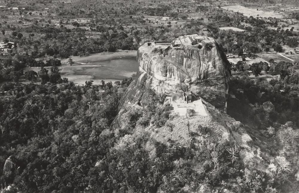
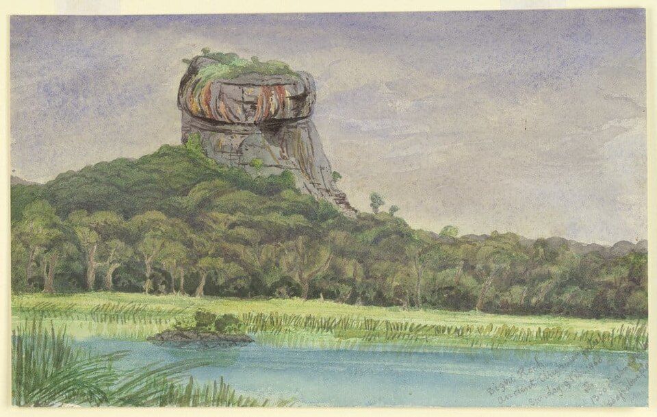
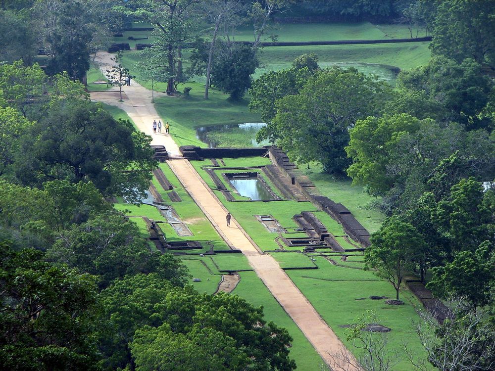
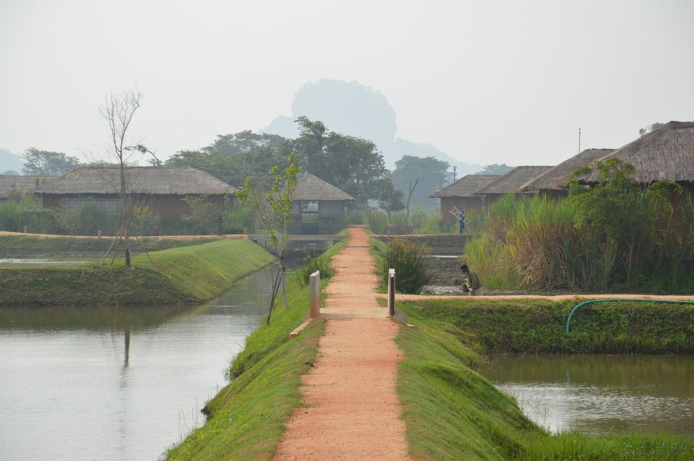
At the rock of Sigiriya, long attributed to King Kassapa I, the gardens take three forms: water gardens in the western precinct, boulder gardens linked by winding paths, and terraces shaped from the hill at the rock's base.
How it came about and changed
- 3rd century BCE onward
The rock and its boulders were inhabited from the 3rd century BCE, as graffiti in caves and shelters used by Buddhist monks attest; about thirty boulders hold rock shelters converted for ascetics and later monastic dwellings, some with drip ledges and paintings.14
- 477–495
King Kassapa I, who seized power after the killing of his father Dhatusena, built a fortified palace and capital at Sigiriya; he was defeated in 495 and his brother Moggallana returned the site to the monks. A tradition recorded in the 13th-century Culavamsa credits Kassapa with clearing the land, building a wall and a lion staircase; the scholar Divya Kumar-Dumas notes that neither inscriptions nor scientific dates support crediting him with the water architecture.134
- 5th century and later (design)
The plan is a 1 × 3 km rectangle bounded by moats and earthen mounds, with about 15 ha of terraces around the 180 m rock and walled precincts east and west. The western precinct holds a sequence on an east–west axis: a quadripartite water garden about 115 m on a side, a fountain garden whose limestone plates were fed by gravity through underground pipes, and terraces with an octagonal pool, plus a boulder garden linking the monastic shelters.41
- 7th–13th centuries
Visitors inscribed more than 1,400 verses on the plastered Mirror Wall; ICOMOS describes these 'Sigiri graffiti' as among the oldest texts in Sinhalese, and Kumar-Dumas argues that the wall's place on the main axis makes it the site's key landscape-planning feature.41
- Late 19th century – 1956
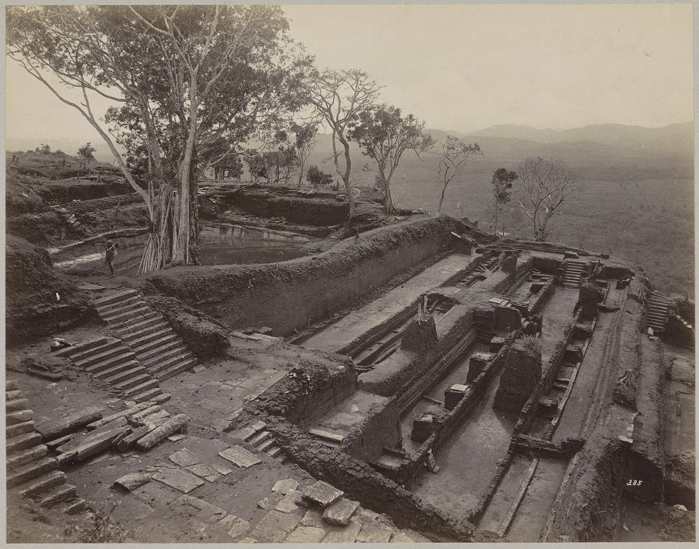
The remains drew interpretation from the late 19th century as a palace complex. In the mid-20th century excavations at the base exposed the rectilinear water terraces, and Senarat Paranavitana (Archaeological Commissioner 1940–1956) first described Sigiriya as a garden.4
- 1960–1963
A new drive diverted the Inamaluva–Sigiriya road toward the old Western Gate so that visitors could approach along the ancient east–west axis; by the 1980s conservation archaeologists presented that path as the main route and curated views of the water gardens along it.4
- 1980–1997
Following a campaign for UNESCO assistance led by the Department of Archaeology, the UNESCO–Sri Lanka Cultural Triangle Project carried out conservation at Anuradhapura, Polonnaruwa, Sigiriya, Dambulla and Kandy, with the Central Cultural Fund established in 1980 to manage its funds. ICOMOS's 1982 evaluation notes the aristocratic quarter's terraced gardens with canals and fountains as recently cleared of invading forest.51
- 1982–present
Inscribed on the World Heritage List in December 1982. Only about a third of the site has been carefully surveyed and less excavated; the full extent of the constructed landscape remains unknown. A site museum built with Japanese (JICA) aid opened in July 2009.245




Approvals and legal steps
- 1940 Sri Lanka's cultural heritage protection is based on the Antiquities Ordinance of 1940 (amended 1956 and 1998), administered by the Department of Archaeology.5
- 1980 Sri Lanka ratified the World Heritage Convention, and the Central Cultural Fund was established to manage funds for the Cultural Triangle projects.5
- 1982 ICOMOS recommended inscription (May 1982) under criteria (ii), (iii) and (iv); the World Heritage Committee's sixth session (Paris, 13–17 December 1982) inscribed the Ancient City of Sigiriya (No. 202).12
Funding
- 477–495 Construction is traditionally attributed to the patronage of King Kassapa I; no source quantifies it.14
- 1st millennium CE Lay patrons of ascetics and monastic communities sponsored embellishments to the rock-shelter dwellings (drip ledges, paintings) as meritorious acts; an early inscription records a donation of monastic dwellings and audience halls.4
- 1980–1997 Modern excavation and conservation was funded through the UNESCO–Sri Lanka Cultural Triangle Project, with funds managed by the Central Cultural Fund.5
- 2009 Japan's JICA provided aid for construction of the Sigiriya Museum (opened July 2009).5
People
- King Kassapa (Kashyapa) I Ruler (r. 477–495) traditionally credited with building the palace and capital
- Moggallana Kassapa's brother; returned the site to the monks after 495
- Buddhist monastic communities Occupants of rock shelters before and after Kassapa; possible designers of later features (interpretation by Kumar-Dumas)
- Senarat Paranavitana Archaeological Commissioner 1940–1956; first described Sigiriya as a garden
- C. E. Godakumbura Archaeological Commissioner 1961–1967; reported post-Kassapan monastic alterations
- Senake Bandaranayake Conservation archaeologist; publicised the gardens internationally (ICOMOS 1993) and published the main studies
- Roland Silva Led the campaign for UNESCO assistance that produced the Cultural Triangle Project
- Department of Archaeology, Sri Lanka Statutory heritage authority under the Antiquities Ordinance
- Central Cultural Fund Fund established 1980 to manage Cultural Triangle project funds
- Divya Kumar-Dumas Scholar whose 2018 Orientations article analyses the landscape design
Sources for this page
- ICOMOS / UNESCO World Heritage Centre, ICOMOS evaluation: Ancient City of Sigiriya (No. 202), May 1982
- UNESCO, World Heritage Committee, Sixth Session (Paris, 13–17 December 1982): Report of the Rapporteur (CLT-82/CH/CONF.015/8)
- UNESCO World Heritage Centre, Ancient City of Sigiriya (UNESCO/NHK)
- Orientations magazine, Sigiriya: An Early Designed Landscape in Sri Lanka (Divya Kumar-Dumas, January/February 2018)
- Japan Consortium for International Cooperation in Cultural Heritage (JCIC-Heritage), Survey Report on the Protection and Utilisation of Cultural Property in the Northern and Northeastern Provinces of Sri Lanka (March 2015)
- Wikidata, Sigiriya (Q272153)
Researched on 2026-11-19 from the sources listed; a fact that could not be confirmed in a source was left out. Pictures are public domain or under an open licence, credited as their file page asks.
The question it brings · interpretation
Where a site moves from flat ground to rock, how might the geometry of the design change with the terrain rather than being imposed evenly across it?
Each question is Field Method’s interpretation, not a claim made by the source.
The date
Nominal year for ordering: the start of the reign of King Kassapa I (477–95), the date the UNESCO page gives for the capital. No construction year for the gardens is established; the opened scholarly article says the attribution to Kassapa is a long tradition that inscriptions and scientific dates do not clearly support.