2006
Room for the River programme
Rijkswaterstaat with Dutch central government, regional authorities and residents · Rhine branches (IJssel, Waal, Lower Rhine, Lek), Netherlands
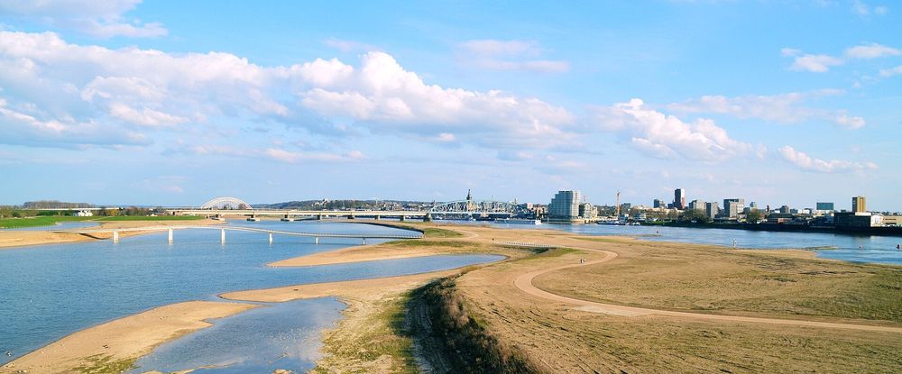
Measures at 34 locations along the Rhine branches gave rivers more space by moving dikes inland, digging side channels and lowering floodplains, while creating new areas for nature and recreation.
How it came about and changed
- 1926–1995
After the 1926 dike breaches along the main rivers, Dutch policy emphasised containment: rivers were straightened, dikes raised and spillways closed (the Beerse Overlaat was closed off in 1942). In 1993 and especially 1995 extreme discharges brought the Rhine and Meuse to dangerously high levels; about 250,000 people and 1 million animals were evacuated as a precaution in Gelderland in 1995, though no dikes failed.21
- 1995–2005
Dikes were reinforced at an accelerated pace under the Delta Plan for Major Rivers, and in 2000 'room for the river' became the guiding principle for flood protection in the river basin: instead of continually raising dikes, water levels would be lowered by widening the rivers. The Room for the River programme followed in 2002, and a draft Planologische Kernbeslissing (national spatial planning key decision, PKB) was submitted to parliament on 15 April 2005.123
- 2006–2007
The PKB set a coherent package of measures to bring the Rhine branches to the legally required protection level by 2015, sized for a design Rhine discharge of 16,000 m³/s, with a second objective of improving the spatial quality of the river area; it also reserved space for river-widening measures that might be needed after 2015. The Tweede Kamer approved it on 7 July 2006 (supplement 31 October 2006) and the Eerste Kamer on 19 December 2006; the Kabinet's final text (PKB part 4) was published in January 2007.345
- 2007–2019
Implementation began in 2007. Central government and regional authorities, working with residents, carried out 39 measures at 34 locations along the IJssel, Waal, Nederrijn (Lower Rhine) and Lek, including floodplain lowering, side channels, dike relocation and depoldering (the Noordwaard, about 4,450 ha, reorganised from 2009). The programme was officially completed with the opening of the Reevediep flood channel in early 2019.21
- 2012–2016
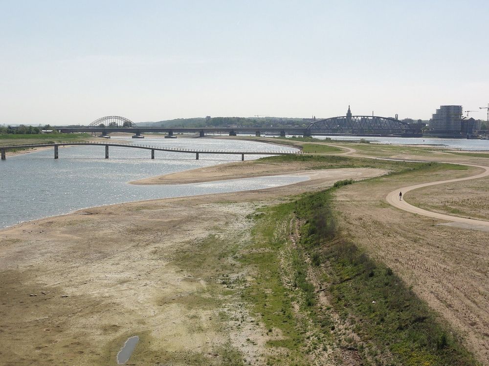
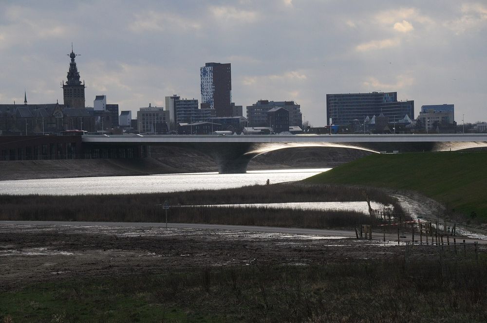
The largest urban project, Room for the Waal at Nijmegen-Lent, moved the dike at Lent about 350 m inland and dug a bypass channel (the Spiegelwaal), creating an island and urban river park; work began in 2012 and was completed by 2016, with a reported 35 cm reduction in high water level against a target of 27 cm. H+N+S Landscape Architects describe themselves as coordinating architect for the contracting consortium and responsible for the landscape design.67
- 2019–present
After completion, new problems became prominent: riverbed erosion, falling groundwater levels and an increasingly uneven distribution of water between the Rhine branches; high water in 2021 exceeded the 1993 and 1995 levels. Room for the River 2.0 was launched in April 2025, with decisions on riverbed measures and on the space rivers need inside and outside the dikes expected in 2026.21



Approvals and legal steps
- 2005–2006 Planologische Kernbeslissing Ruimte voor de Rivier (parliamentary file 30 080): submitted 15 April 2005; approved by the Tweede Kamer on 7 July 2006 (supplement on 31 October 2006) and by the Eerste Kamer on 19 December 2006. It fixed the measures needed by 2015 and reserved land for later river widening.34
- 2007 Final PKB text (part 4, January 2007) published as a parliamentary paper.4
Funding
- 2006–2019 The Room for the River programme cost a total of €2.3 billion (Rijkswaterstaat).1
- 2006 The PKB states that a fixed task budget (taakstellend budget) was available for the 2015 package; the amount was not found in the part of the PKB read.4
- 2012–2016 Room for the Waal (Nijmegen): total cost estimated at €351 million, mainly from the national budget; the EEA case study says the programme was coordinated and largely funded by national government, with additional funds from provinces, water boards and municipalities.6
People
- Rijkswaterstaat (Ministry of Infrastructure and Water Management) Programme implementation
- Ministry of Verkeer en Waterstaat (Minister / State Secretary) Signatory and proponent of the PKB
- Provinces, water boards and municipalities Regional partners and co-funders
- Residents of the river area Helped identify locations and choose between measures
- Municipality of Nijmegen Client (with the Room for the River project office) for Room for the Waal
- H+N+S Landschapsarchitecten Coordinating architect for the contracting consortium and landscape design, Nijmegen
- NEXT Architects, Zwarts & Jansma, Ney & Partners, Dura Vermeer, Ploegam, Trafique Partners listed by H+N+S on the Nijmegen project
- Ralph Schielen Rijkswaterstaat senior advisor quoted on the programme's history
Sources for this page
- Rijkswaterstaat, Room for the River
- Rijkswaterstaat, Living alongside rivers means living with water (9 February 2026)
- Eerste Kamer der Staten-Generaal, Ruimte voor de rivier (30.080)
- Officiële bekendmakingen (Dutch government), Planologische Kernbeslissing Ruimte voor de Rivier, deel 4 (January 2007), Kamerstuk 30080 nr. 23 bijlage
- Officiële bekendmakingen (Dutch government), Planologische kernbeslissing Ruimte voor de rivier, Deel 3: Kabinetsstandpunt, Kamerstuk 30080 nr. 4
- Climate-ADAPT, European Environment Agency, Room for the River Waal – protecting the city of Nijmegen
- H+N+S Landschapsarchitecten, River expansion + City park: Room for the River Nijmegen
Researched on 2026-11-19 from the sources listed; a fact that could not be confirmed in a source was left out. Pictures are public domain or under an open licence, credited as their file page asks.
The question it brings · interpretation
Instead of raising the edge, where could this river or channel be given more room, and what would that space be used for between floods?
Each question is Field Method’s interpretation, not a claim made by the source.
The date
Rijkswaterstaat dates the programme 2006-2019, finishing in early 2019 with the Reevediep flood channel. A February 2026 Rijkswaterstaat news item says the planning decision for the full package was adopted in 2005 and implementation began in 2007, with 39 measures at 34 locations. Year used: 2006 programme start.