from the 1590s
Meidan Emam (Naqsh-e Jahan Square) and the Chahar Bagh avenue, Isfahan
Shah Abbas I · Isfahan, Iran
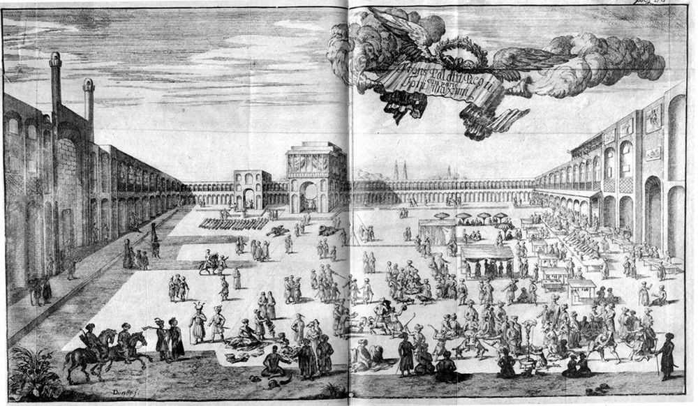
The royal city of Shah Abbas I, who moved his capital to Isfahan in 1598: a rectangular square lined with two levels of shops, a monument centred on each side, and a wide avenue to the Zayandeh River.
How it came about and changed
- 1598
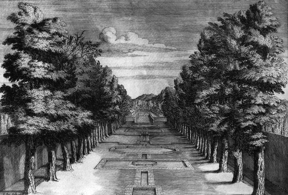
Shah Abbas I (r. 1588–1629) moved the Safavid capital to Isfahan and built a royal city south of the old city, connected to the Zayandeh river by the wide Chahar Bagh ('Four Gardens') avenue; his royal buildings were organised around the central maydan or along the Chahar Bagh.1
- c. 1598–1602
According to historical documents reviewed by Khosravi (2020), levelling the ground as a polo and riding field was the first step in building the square. After its completion in 1602, rows of shading plane trees along a running-water stream were built around it, the central area was left bare, and twelve main entrances were made; stone polo posts marked the field's north and south ends.3
- 1602–1638
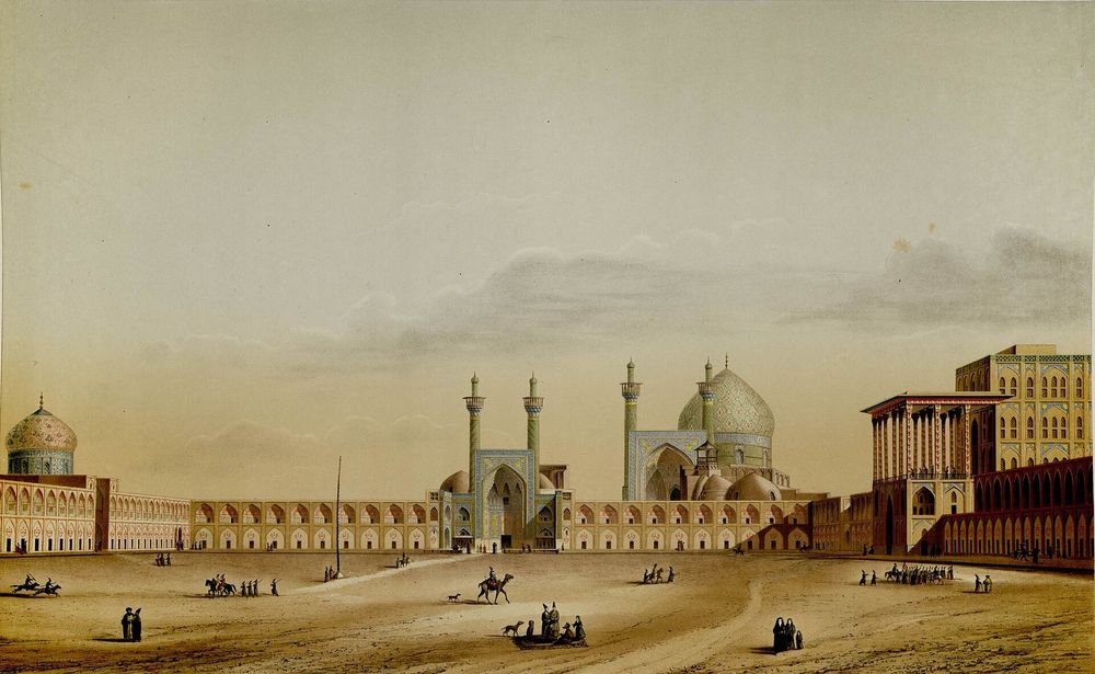
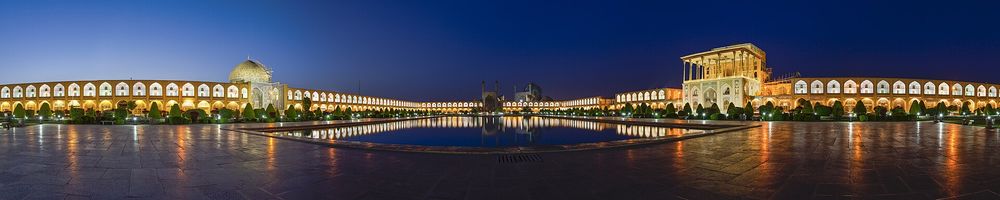
The monuments on the square's sides were added: the Sheikh Lotfallah Mosque on the east side (constructed in 1602, used as the private oratory of the shah and his family) and the congregational Masjid-i Shah on the south side (built 1612–1638). UNESCO describes the whole as a homogeneous ensemble built over a short time span to a coherent plan, with Ali Qapu on the west and the Qeyssariyeh portico to the bazaar on the north.12
- 1617–1722
European travellers (Della Valle, Figueroa, Olearius, Chardin, 1617–1664) described the square's polo games, music and markets; UNESCO notes the sandy esplanade was used for celebrations, promenades, polo, assembling troops and public executions, with hundreds of shops in the arcades. Polo declined after the conquest of Isfahan in 1722.32
- 1886–1937
Brugsch described the field as deserted in 1886, and polo was no longer played there by 1887 according to D'Allemagne; between autumn 1935 and spring 1937 Schmidt recorded the first changes to the polo field (gardens and ponds) that gave the square a new identity.3
- 20th century–1990s
UNESCO records that the once sandy surface is now paved with stone, a pond was placed at the centre, lawns were installed in the 1990s and two entrances were added to the northeastern and western ranges.2
- 1979–present
Inscribed on the World Heritage List in 1979. The property and buffer zone are administered by the Iranian Cultural Heritage, Handicrafts and Tourism Organization through its Esfahan office; the square enclosure belongs to the municipality and the surrounding bazaars and shops to the Endowments Office. UNESCO notes there is a municipal plan but no management plan, and lists development pressure in the buffer zone, road widening, tourism and fire as threats.2



Approvals and legal steps
- 1932 Registered in Iran's national list of monuments as item no. 102 on 5 January 1932, under the National Heritage Protection Law (1930, updated 1998); later also protected under the Law on the Conservation of National Monuments (1982). The Royal Mosque (no. 107), Sheikh Lotfallah Mosque (no. 105), Ali Qapu (no. 104) and Qeyssariyeh portico (no. 103) are registered individually.2
- 1979 Inscribed on the UNESCO World Heritage List as 'Meidan Emam, Esfahan' (property 115).2
Funding
- current UNESCO's statement of Outstanding Universal Value says financial resources for the property, which it describes as inadequate, are provided through national, provincial and municipal budgets and by private individuals; the managing organisation is administered and funded by the Government of Iran.2
People
- Shah Abbas I Safavid ruler (r. 1588–1629) who moved the capital to Isfahan in 1598 and built the royal city, maydan and Chahar Bagh (MIT OCW; UNESCO)
- Iranian Cultural Heritage, Handicrafts and Tourism Organization (Esfahan office) Administers and supervises the World Heritage property and buffer zone (UNESCO)
- Municipality of Isfahan Owner of the square enclosure (UNESCO)
- Endowments Office Owner of the bazaars around the square and shops in its environs (UNESCO)
- Riza-i Abbasi Head of the Isfahan school of painting under Shah Abbas; UNESCO notes figurative compositions in his style among the square's decoration
Sources for this page
- MIT OpenCourseWare, 18. The Maydan-i-Shah in Isfahan, the Safavid Capital (lecture notes, 4.614 Religious Architecture and Islamic Cultures, Prof. Nasser Rabbat)
- UNESCO World Heritage Centre open data (data.unesco.org, dataset whc001), Meidan Emam, Esfahan (World Heritage List record 115: description, statement of Outstanding Universal Value, criteria, protection and management)
- Journal of Iranian Architecture & Urbanism (JIAU), Khosravi, M. (2020). Polo & Naqsh-e Jahan: Redefining the Culture and Identity of Iranian-Islamic Architecture. Journal of Iranian Architecture & Urbanism 11(2), 253–273. doi:10.30475/isau.2020.147682.1086 (English extended abstract)
- Wikidata (pointer only), Chaharbagh (Q746410)
- Wikidata (pointer only), Naqsh-e Jahan Square (Q4519)
Researched on 2026-11-19 from the sources listed; a fact that could not be confirmed in a source was left out. Pictures are public domain or under an open licence, credited as their file page asks.
The question it brings · interpretation
If you had only one square and one avenue to organise a new district, what would each have to connect, and who would be free to use them?
Each question is Field Method’s interpretation, not a claim made by the source.
The date
Nominal year for ordering: 1598 is the year Shah Abbas I moved the Safavid capital to Isfahan (MIT). Opened sources disagree on the square: an MIT Libraries record dates it 1590-1602, Wikipedia 1598-1629.