1879
Back Bay Fens
Frederick Law Olmsted, with John Charles Olmsted · Boston, Massachusetts, United States
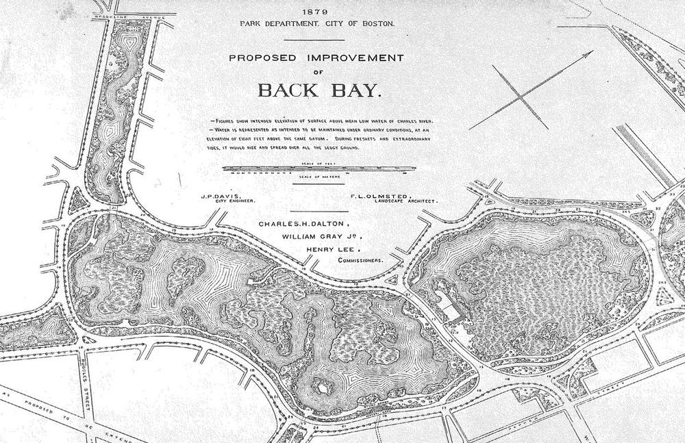
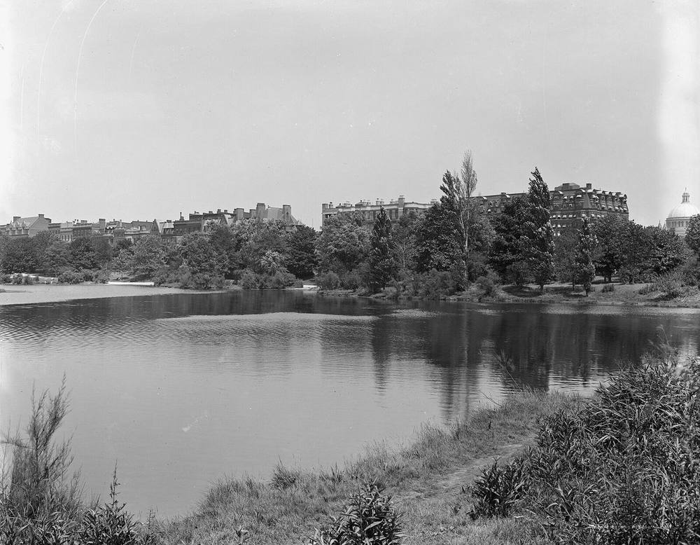
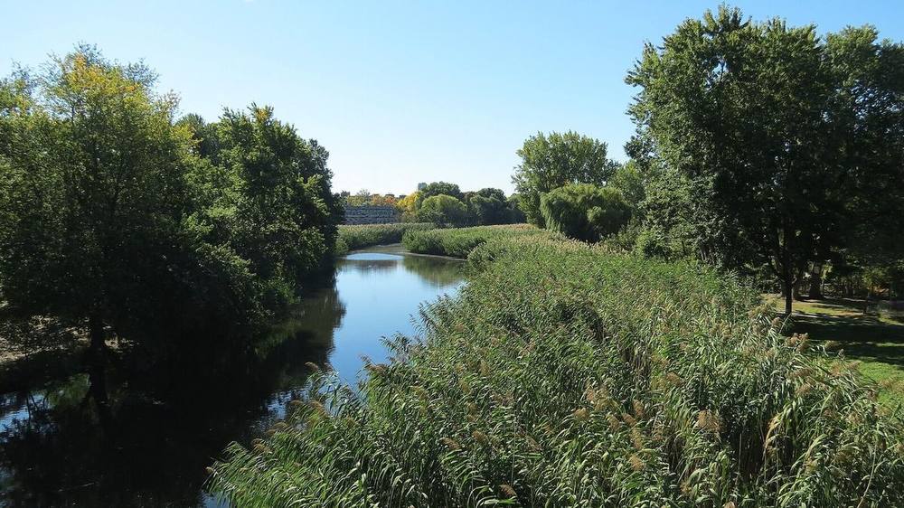
Olmsted reshaped tidal flats that received the city's sewage into a planted salt marsh able to take floodwater, as one link in Boston's Emerald Necklace; the 1910 Charles River dam later turned it to fresh water.
How it came about and changed
- 1869–1877
After a failed 1870 park act, Boston's Park Act was accepted by voters on 9 June 1875; the Park Commissioners' report of 24 April 1876 proposed a park system, and in 1877 the city appropriated about half a million dollars to buy 100 acres of land and flats in the Back Bay 'Full Basin', a polluted tidal flat whose treatment was seen as a sanitary necessity.1
- 1878–1879
A design competition was held in 1878; Olmsted declined to enter or judge it, and the $500 prize went to Hermann Grundel, whose plan was judged inappropriate. Olmsted began advising the commission in 1878 and in 1879 drew the plan: a storage basin for Stony Brook floodwater with a regulated tidal salt creek and salt-marsh planting, rather than a conventional park. John Charles Olmsted assisted.124
- 1880–1895
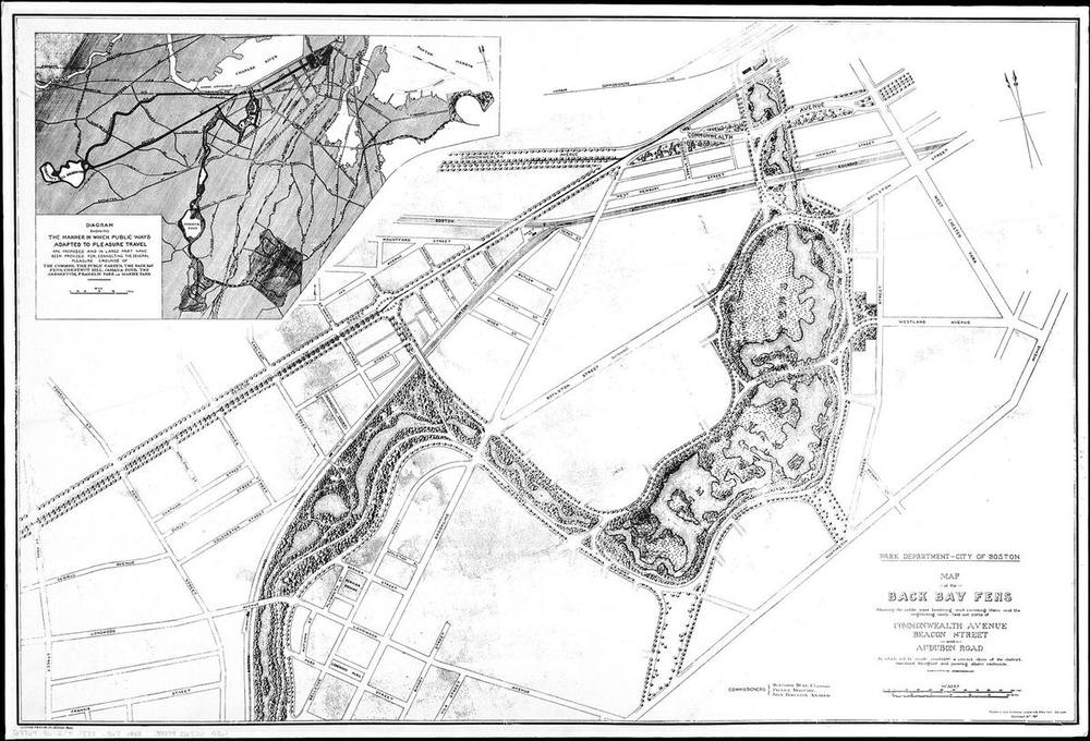
Work on the Fens ran from 1881 to 1895. H. H. Richardson's Stony Brook gatehouse was completed in 1882 and the Boylston Street Bridge (plans by John C. Olmsted, towers by Richardson) opened in 1884; John C. Olmsted's Agassiz Road bridge (1887–88) and Fen Bridge (1891–92) followed. In December 1887 the commission voted to continue the parkway up the Muddy River valley; major construction of the Fens was completed in 1893.12
- 1903–1910
Continuing pollution led to a foul-flow channel begun in 1903 and a second gatehouse (Shepley, Rutan and Coolidge) in 1905. The Charles River dam, completed in 1910, turned the Fens water fresh, ending the tidal design; the salt-marsh plants died out.123
- 1911–1949
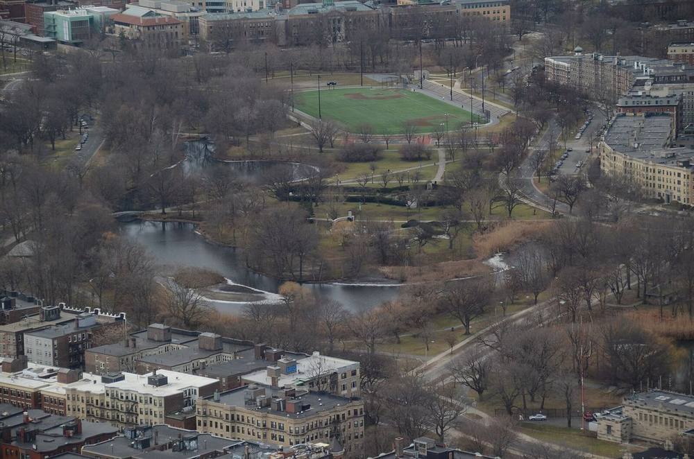
Marshes were filled in stages; an athletic field (1912, landscaped 1925–28) and fill for the Victory Gardens site began in 1911. Arthur Shurcliff (Shurtleff) redesigned the southern Fens from 1921, including the Rose Garden (1930, enlarged 1933); a Victory Garden was planted in 1941 and the War Memorial built in 1949.123
- 1956–1983
In 1956 care of the parkways passed to the Metropolitan District Commission; a lagoon and bridge were lost to a parking lot in 1958–59 and the Bowker Overpass cut Charlesgate. The Fens was listed in the National Register in 1971 as part of the Olmsted Park System; Carol R. Johnson Associates prepared a master plan in 1977; road and entrance changes were made in 1982.12
- 1989–present
The Fens was included in the Emerald Necklace master plan (Walmsley/Pressley joint venture, 1989), and Pressley Associates restored the Agassiz Bridge and rehabilitated the Victory Gardens 1989–93. The park is owned by the City of Boston; the Emerald Necklace Conservancy advocates for and helps care for it.231




Approvals and legal steps
- 1875 Boston Park Act, accepted by a majority at a special election on 9 June 1875, after which the mayor appointed three Park Commissioners.1
- 1877 City appropriation to purchase about 100 acres of land and flats at the Back Bay.1
- 1887 Boston Park Commission vote of 30 December 1887 for a continuous parkway from the Fens to Franklin Park via the Muddy River valley.1
- 1956 Transfer of care, control and maintenance of the Fenway and other parkways to the Metropolitan District Commission.1
- 1971 Listed in the National Register of Historic Places as part of the Olmsted Park System.21
- 1983 (not verified) Boston Landmarks Commission staff recommended designation as a Landmark under Chapter 772 of the Acts of 1975; secondary sources give designation on 11 November 1983, but no primary record of the vote was opened.1
Funding
- 1877 About half a million dollars appropriated for the land; the Landmarks report gives the purchase price of the 100 acres as $450,000.1
- 1885–1896 By 1885 land and construction for six park sites had cost four million dollars; after a low tax and debt limit was set, the Board continued work with long-term loans outside the debt limit.1
- 1893 The Landmarks report states the Fens was completed in 1893 at a cost of $18,000,000 (see notes).1
- 1903 The Johnson Memorial gateway at the Westland Avenue entrance was paid for by Helen Johnson in memory of her husband.1
People
- Frederick Law Olmsted Landscape architect; advised the Park Commission from 1878 and drew the 1879 plan
- John Charles Olmsted Assisted on the plan; drew the Boylston Street Bridge plans and designed Agassiz Road and Fen bridges
- Boston Park Commission (T. Jefferson Coolidge, Charles H. Dalton, William Gray Jr.) Client; first commissioners appointed after the 1875 Act
- Henry Hobson Richardson Architect of the Stony Brook gatehouse (1882) and the Boylston Street Bridge towers
- Hermann Grundel Winner of the 1878 design competition prize; plan not used
- Thomas Doane Park Commission engineer who superintended filling and border roads
- Shepley, Rutan and Coolidge Architects of the 1905 gatehouse and other park bridges
- Arthur A. Shurcliff (Shurtleff) Landscape architect of the 1920s–30s redesign, including the Rose Garden
- Carol R. Johnson Associates 1977 master plan
- Walmsley/Pressley joint venture; Pressley Associates 1989 Emerald Necklace master plan; 1989–93 restoration work
- Emerald Necklace Conservancy Non-profit partner for the park system
Sources for this page
- Boston Landmarks Commission, City of Boston, Report of the Boston Landmarks Commission on the potential designation of Back Bay Fens as a Landmark
- The Cultural Landscape Foundation, Back Bay Fens
- City of Boston Parks and Recreation, Back Bay Fens
- Olmsted Network, Fens - Back Bay (cited by the entry; not readable from this environment)
- Wikidata, Back Bay Fens (Q798303)
Researched on 2026-11-19 from the sources listed; a fact that could not be confirmed in a source was left out. Pictures are public domain or under an open licence, credited as their file page asks.
The question it brings · interpretation
The marsh was designed for tides that a later dam removed; which condition is your own design depending on that someone else could change?
Each question is Field Method’s interpretation, not a claim made by the source.
The date
Year of Olmsted's plan, as given by The Cultural Landscape Foundation and the Boston Landmarks Commission. He began advising the park commission in 1878; the Landmarks report dates work on the Fens 1881-1895.